Lanzarote Airport (ACE)
City Orientation and Maps
(Lanzarote, Spain)
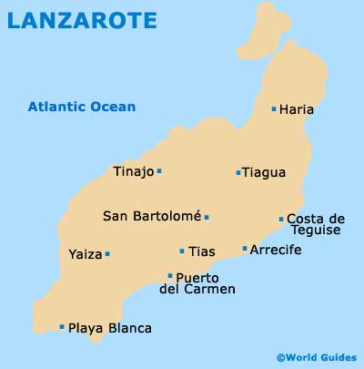
The island of Lanzarote is the most easterly of the famed Canary Islands and is situated directly north of Fuerteventura. Lanzarote is sited a long way south-west from mainland Spain and is actually closer to Morocco and Algeria than Spain.
The most popular towns and resorts on Lanzarote can be found around the coast, with huge expanses of beachfronts located alongside the Atlantic Ocean. Arrecife is the capital of Lanzarote and is conveniently close to Lanzarote Airport (ACE), lying to the east.
Lanzarote Airport (ACE) Maps: Important City Districts
Those looking for sun and sand should consider heading to the resorts of Playa del Carmen, on the south-easterly coastline, and Playa Blanca on the most southerly shores of Lanzarote. The Playa del Carmen is the island's premier beach resort and is centred around the busy Avenida Playas, while the Playa Blanca is not so developed and offers a sweep of sandy beaches and regular crossings to nearby Fuerteventura.
Other areas of interest on Lanzarote include the Mirador del Rio on the north-westerly side of the island, which is known for its stunning views, and Guinate, home to the Tropical Park, featuring exotic birds and beautifully landscaped gardens. Also of interest, the Costa Teguise lies around 14 km / 9 miles north-east of Lanzarote Airport and close to Arrecife. The Costa Teguise is a low-rise resort with a good selection of small sandy beaches, including the Playa de las Cucharas.
Spain Map

Lanzarote Map